| Irish Forums Message Discussion :: Great Famine population change emigration partition online |
   | Irish Forums :: The Irish Message
Forums About Ireland and the Irish Community, For the Irish home and Abroad. Forums include- Irish Music, Irish History, The Irish Diaspora, Irish Culture, Irish Sports, Astrology, Mystic, Irish Ancestry, Genealogy, Irish Travel, Irish Reunited and Craic
|  
|
Great Famine population change emigration partition online


|
|
|
| Irish
Author |
Great Famine population change emigration partition online Sceala Irish Craic Forum Irish Message |
|
Clan Malley
Sceala Philosopher
|
| Sceala Irish Craic Forum Discussion:
Great Famine population change emigration partition online
|
|
|
New resource for those of us interested in studying the effects of An Gorta Mor , the great famine in Ireland.
NCG Online Atlas Portal
Here we provide users access to two online historic atlases : The Irish Famine Population Data Atlas 1841-2002 and The Atlas of Irish Famine Data 1841 - 1851.
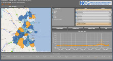
Irish Population Change Atlas.

Screen Shot of the Population Change Atlas
The Irish famine population atlas provides population data for all 32 counties within the Island of Ireland from 1841 to 2002. Data is available at Electoral Division level, at a consistent set of 3432 EDs, which is based on the 1851 Electoral Division boundaries.The data used in this population atlas is from 16 censuses, taken in both the Republic and the North of Ireland between 1841 and 2002.
The above online atlas can also be viewed at: airo.ie!
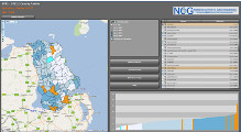
Irish Famine Data Atlas.

Screen Shot of the Famine Data Atlas
The Irish famine is a key event in Irish history. This online Atlas of Irish Famine Data provides users with access to population and agricultural data for Ireland for this period. Using data from the Census of Population 1851 and the Agricultural Census of 1841 users can examine aspects of the Irish human and physical landscape at this time in Irish history.
For further information, please contact Mary Kelly, Caroline Treacy or Prof. Stewart Fotheringham on +353 (0)1 7086243.
ncg.nuim.ie/
These Online Atlas projects have been funded by an IRCHSS Senior Research Scholarship awarded to Professor Stewart Fotheringham in 2010 and by the National Centre for Geocomputation, NUI Maynooth
Ireland's population trend goes digital
Changes in Ireland's population over the last 160 years have been mapped out on-line.
Two digitised atlases devised by the National Centre for Geocomputation at NUI Maynooth reveal the levels of emigration throughout the Great Famine and the partition of the island up to the Celtic Tiger boom.
The atlases chart the recent populations of all counties relative to their maximum of 1841.
Leitrim is lowest at 17 per cent, while Dublin is greatest at 303 per cent.
Researchers also found the average population loss during famine times was 20 per cent - but the figure rose to 30 per cent in all Connacht counties with many local areas in the west of Ireland losing between 40 and 60 per cent of their populations.
examiner.ie/breakingnews/ireland/irelands-population-trend-goes-digital-515235.html
EVERY SCHOOLCHILD in Ireland is taught that the population of the country declined by two million people during the Famine.
For the first time that decline is charted on a locality-by-locality basis by a team based at NUI Maynooth’s National Centre for Geocomputation.
The team, led by its director Prof Stewart Fotheringham, has taken census data from 3,452 electoral districts and mapped the changes in population from 1841 to 2002, the last year in which it is possible to compare figures on an all-Ireland basis because the North only has a census every 10 years.
Although Ireland’s population decline after the famine has been well documented, the census information has not been collated in such a comprehensive fashion before.
The atlas of Irish Famine data 1841-1851 takes a detailed look at Ireland throughout the Famine years, charting population decline and changing agricultural practices.
The population change atlas 1841-2002 demonstrates how the decline in Famine population continued inexorably in many places until recently.
Examination of data from between 1841 and 1851 demonstrated how the impact of the Famine differed from area to area.
In Roscommon, which lost a third of its population during the Famine decade, there is a marked contrast between the east of the county and the west.
In west Roscommon the notorious landlord Maj Denis Mahon, who was shot dead in 1847, forcibly evicted thousands of his tenants, with some parishes experiencing a 60 per cent decline in population.
In east Roscommon, where conditions were more benign, the population decline was below 10 per cent.
In Mayo, Westport, which was a busy Famine port and had a large workhouse, experienced a 15 per cent growth in population, while neighbouring Killavalley (Killawalla) lost two-thirds of its population, the biggest decline in the country.
The map of population changes between 1841 and 1851 is speckled with places that actually increased in population.
Most of these are accounted for by the flight to cities such as Dublin, Cork, Cobh and Limerick, but isolated pockets of red also denoted places like Kanturk in Cork, Scariff in Clare, Belmullet in Co Mayo and Bahaghs (Caherciveen) in Co Kerry, where workhouses were located.
Skibbereen, the location for the Famine song of the same name, only experienced a 2.6 per cent decrease in population during the decade and it was not so lonely round the fields of Athenry, which escaped the worst ravages of the Famine with a 5.7 per cent decrease.
The second atlas uses all the census data since 1841 to show the changes in population throughout the country.
In 2002 Leitrim had only 17 per cent of the population it had in 1841, when 155,000 people lived in the county, making it the worst affected county for population loss. Garvagh in the north of the county only had 4 per cent of the population that it had before the Famine, going from 1,750 in 1841 to just 67 people in 2002.
Prof Fotheringham said they were lucky that Ireland has had a remarkable continuity in electoral districts which made like-for-like comparisons possible.
He hoped to use the forthcoming census data for the north of Ireland to make it as up-to-date as possible.
The project has taken two years and it was jointly funded by the Irish Research Council for Humanities and Social Sciences and by NUI Maynooth.
Prof Fotheringham said that it put Ireland in the “forefront of demographic research”.
He said he hoped it would be a valuable tool for local historians to tease out the story behind the figures.
irishtimes.com/newspaper/ireland/2011/0803/1224301773629.html
The Roles & Attitudes of Irish Protestants During the Potato Famine
Irish Famine Memorial in Sydney Australia
Information studies papers about The Irish famine
|
|
|
|
|
|
|
|
|
|


