| Irish Forums Message Discussion :: Cavehill Belfast |
   | Irish Forums :: The Irish Message
Forums About Ireland and the Irish Community, For the Irish home and Abroad. Forums include- Irish Music, Irish History, The Irish Diaspora, Irish Culture, Irish Sports, Astrology, Mystic, Irish Ancestry, Genealogy, Irish Travel, Irish Reunited and Craic
|  
|
Cavehill Belfast


|
|
|
| Irish
Author |
Cavehill Belfast Sceala Irish Craic Forum Irish Message |
Irish News

|
| Sceala Irish Craic Forum Discussion:
Cavehill Belfast
|
|
|
Cavehill, the rugged basaltic hill which overlooks Belfast, and Jonathan Swift's inspiration for the giant in his Gulliver's Travels, is to undergo an improvement programme.
Belfast City Council is looking for volunteers to help it complete the task. The work will involve upgrading the pathways, to give easier access for the 140,000 visitors to Cavehill Country Park park annually.
Steps will also be erected, drainage channels constructed and vegetation cleared and planted. Stones and railway sleepers will have to be airlifted in as road access to the site is too difficult.
Belfast City Council Countryside Officer, Anne Reid said: "Cavehill Country Park is a very popular location for countryside recreation; attracting walkers, joggers and cyclists, both local and international. "These works will allow some of the paths within the park to be brought up to a better standard than at present."

The park will be closed to the public while materials are being delivered, but once that's done the council wants volunteers to help us carry out the work.
The path around the Devil's Punchbowl will be closed for about six weeks and there will be notices about other closures and alternative routes.
The project is expected to take about three months to complete.
"If members of the public would like to volunteer to help us with this work we would be more than grateful to have the extra hands and also they can visit the park in future knowing that they have helped protect its future," Ms Reid added.
The news follows upon the efforts of The Cave Hill Conservation campaign
The Cave Hill Conservation Campaign is a voluntary group of approximately 100 people based in Belfast. It was founded in 1989 to counter the threat of a prospecting licence for the mineral zeolite being issued for the Cave Hill. The Campaign organised a petition which attracted over 11,000 signatures and helped to see off the threat of mining in the area. Today, the Campaign operates through an active committee which meets monthly.
The Campaign's objectives are as follows:
* To secure the preservation of the Cave Hill as a natural and unspoiled environment.
* To encourage public access for appropriate purposes.
* To encourage Belfast City Council (the principal landowner) to adopt an environmentally-friendly management strategy for the Cave Hill.
* To oppose all intrusive development.
* To support the creation of a Belfast Hills Trust.
* To oppose further degradation of the Belfast Hills.
* To support the implementation of environmentally friendly policies for the Belfast Hills.
* To support the creation of public rights of way across the Belfast Hills.
They try to ensure that the Cave Hill's natural environment and public amenity value are protected and, where possible, enhanced. We produce a periodic newsletter, The Cave Hill Campaigner, which keeps members and others up to date with current issues affecting the Cave Hill and the Campaign's activities. Other activities include:
* Organising volunteering activities, such as removing litter, planting trees and clearing invasive species.
* Opposing inappropriate development proposals.
* Collecting data on patterns of use of the Cave Hill, and users' views, by carrying out user surveys.
* Seeking to influence relevant statutory bodies, such as Belfast City Council.
* Seeking to promote the adoption of a comprehensive management strategy for the Cave Hill.
* Working with the other Belfast Hills groups on the Belfast Hills Partnership.
* Developing this website as a reliable and up to date source of information about the Cave Hill, in the context of the other Belfast Hills.
Threats to the Environment of the Cave Hill
In recent years a number of inappropriate development plans have been dropped, after public protest led by our Campaign. These have included a proposal for a cable car and a proposal to develop three acres in the grounds of Belfast Zoo and build a 135 bedroom hotel . This only failed to materialise due to a late breakdown in negotiations between the Council and the developer. An earlier proposal to build chalets in the vicinity of Belfast Castle did not get so far, but should not have seen the light of day. The most recent scheme is to re-zone the old zoo area for development.
Ongoing threats and nuisances include:
Erosion / lack of / paths - the most notable problem is the scree in the Sheep's Path area below McArts Fort. This is the main access route to McArt's Fort from Belfast Castle and is in a dangerous condition. As a result, greater pressure is being put on alternative routes. Although there is a network of paths on the lower slopes, there are no stone paths on the summit area above the caves and to the right of the caves at the foot of the escarpment.
Invasive tree and plant species - sycamore trees are prolific spreaders and they reduce the ground flora because of their heavy shade. There is a similar problem with laurel and rhododendron. We are now involved in an ongoing control programme.
The crow population - especially magpies - has grown considerably in recent years and is now a threat to the numbers and diversity of other woodland birds. In springtime, magpies are prolific nest raiders, taking both eggs and fledglings.
Vandalism - not extensive, but can be very destructive at times, such as when fires are started on the heather moorland.
Scramblers - motor bike scramblers and quads cause a great deal of damage to paths and pose a noisy physical threat to walkers and joggers. Their use in the Country Park is illegal but the law is not enforced effectively. Mountain bikes also cause damage to the paths but are more environmentally acceptable.
These problems should be addressed by the implementation of an appropriate management strategy for the Cave Hill. For example, invasive species can be controlled in the same way that the rhododendron population in the Castle Estate was reduced in the late 1970's. This resulted in a great regeneration of the ground flora, such as bluebells. Periodic culls may be necessary to control the crow population. There are great opportunities for further planting of native tree species and for establishing wild flowers, both of which will encourage wildlife.We are pleased to learn that a comprehensive management strategy drawn up by the Parks Department of Belfast City Council is now expected to be in place by March 2008.
This is the text of the original letter we received from Anne Reid, who is the countryside officer with Belfast City Council. We are pleased that something which we have long campaigned for is now happening, even if it will restrict access to the areas being worked on between 10 January - 31 March 2008:
"January 2008 brings a helicopter to the Country Park with a delivery of stone and sleepers and a group of keen volunteers to upgrade the current path structure. The work will take place from January to March 2008 and will involve erecting steps, widening paths, constructing drainage channels, clearing vegetation, planting etc. This project has been made possible by funding secured from the Environment and Heritage Service, Natural Heritage Grant Programme, and Belfast City Council. The work is going to be carried out by Conservation Volunteers the north of Ireland (CVNI) and will take place from 10 January - 31 March 2008. Whilst these works are ongoing sections of the park will have to be closed to members of the public: Cavehill Country Park, in its entirety, will be closed to members of the public on Thursday 10, Friday 11 and Saturday 12 January 2008, this is due to health and safety reasons when the helicopter is operating across the park. From Sunday 13 January 2008 the path around the Devil's Punchbowl will be closed, it is anticipated that this section will be closed for approximately 6 weeks.
There will be signage in place to inform members of the public of path closures and alternative routes, where possible. Belfast City Council is asking members of the public to be patient while these works are taking place. Community Involvement Belfast City Council are opening this project out and asking members of the local community to come and get involved. The work will be hands on and you will be able to view the finished product which you helped create.
Cavehill information
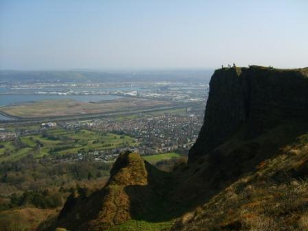
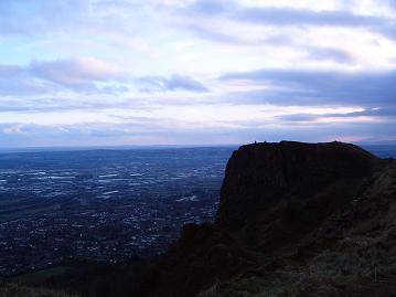
Cavehill is a basaltic hill overlooking the city of Belfast in the north of Ireland. It forms part of the south eastern border of the Antrim Plateau. It is distinguished by its famous "Napoleon's Nose", a basaltic outcrop which resembles the profile of the famous emperor and is said to have inspired the famous novel Gulliver's Travels. Cavehill is also an electoral ward of North Belfast.
It offers views across the city and on clear days the Isle of Man and occasionally Scotland. Like Arthur's Seat, Edinburgh, it offers a strenuous climb, just a few miles from the centre of a major conurbation. The imposing cliffs can be dangerous, with many people requiring rescue after seeking a shortcut to the summit or the higher caves.
General
Cavehill rises to almost 370 metres (1200 feet) above sea level. Most of its lower-east side lies on the Belfast Castle Estate, which has as its focal point the imposing 19th century Scottish baronial castle. The castle was designed by Charles Lanyon and constructed by the Marquess of Donegall in 1872 in The Deer Park. The slopes of Cavehill were originally used as farmland but from the 1880s a major planting exercise was undertaken, producing the now familiar deciduous and coniferous woodland landscape. Belfast Castle Estate was given to Belfast City by the Earl of Shaftesbury in 1934.
There are a number of sites of archaeological interest on the Cave Hill, dating back to the stone age. These include several ringforts (raths) and a lake dwelling (crannog) at Hazelwood. McArt's Fort is on the highest point which is popularly (but inaccurately) known as Napoleon's Nose. It is likely that this was used for ceremonial rather than defence purposes and it appears to date from about three thousand years ago.
Most of the area of the Cave Hill is within the boundaries of the Cave Hill Country Park which, together with Belfast Castle, is owned by Belfast City Council. The Park comprises 750 acres of land. This public ownership protects the area from development and guarantees public right of access. It also gives Belfast City Council the main management responsibility for the Cave Hill.
Cavehill Habitats
The Hill contains a variety of habitats. These include heather moorland, rocky outcrops and mixed woodland. Most of the trees are less than 100 years old, but there are many mature specimens. There has been extensive planting of native species, especially oak, within the last 20 years. The trees are mostly deciduous - ash, beech, birch and rowan are numerous - but there is also a good population of mature scots pine. Smaller growing species include hazel, elder, hawthorn, blackberry and ferns. The area is rich in wild flowers - the better known species include bluebells, primroses, wild garlic, wood anemone, lesser celandine and herb robert. The hazlewood area above the zoo is one of the most important habitats on Cave Hill.
There is also a considerable range of wildlife. Mammal species include foxes, badgers, grey squirrels, hedgehogs, rabbits, shrews and bats. Bird species include owls, kestrels and sparrowhawks as well as the full range of woodland birds such as blackbirds, thrushes, finches, tits, robins, dunnocks and wrens. In summer, there are swallows and house martins. The heather moorland has skylarks, wheatears and pipits.
The Hill is popular with walkers and joggers. There are eight waymarked trails, which range from short easy strolls to challenging 5 mile treks over the summit. There are five access points - Hightown Road, Carrs Glen, Upper Cavehill Road, Belfast Castle and Hazelwood.
Cavehill The Caves
There are 3 large caves. The lowest is 21 feet long, 18 feet wide and varies from 7 to 10 feet in height. Above this is another cave; 10 feet long, 7 feet wide and 6 feet in height. Above this is the third major cave, said to be divided into 2 unequal parts, each of which is more extensive than the larger of the other caves, but the ascent is notoriously dangerous and thus few venture to it.The caves are man-made, and it is postulated that they were originally excavated for iron-mining.
Adjacent to the lowest cave is 'The Devil's Punchbowl', also sometimes called 'The Devil's Cauldron', a site where ancient celtic farmers corraled their cattle. This is mainly comprised of a steep hill, mainly of rocks and boulders, and is considered dangerous to amateurs.
Cavehill History
The hill was known in the original Gaelic as Beann Mheadagáin or the hill of Madigan, after either a king of Uladh ulaid (Ulster) Madigan, who ruled from AD 838 to 855, or a later king Madigan (AD 933-948). The later king's grandson, Eochaid Mac Ardgal, was killed at the battle of Crew Hill in 1003 - in which the Ulidians were defeated by their old enemies, the Kinel-Owen-, and it is from him that McArt's fort derived its name. Ben Madigan, a residential neighbourhood, lies at the foot of Cave Hill's entrance in a wealthy semi-outer city, semi-suburban North Belfast area.
The crowning stone Giant's Chair of the O'Neill clan was apparently sited on Cavehill summit until 1896 and gave its name to the nearby Throne Hospital. The Cavehill Throne was destroyed by British loyalists in December 1896 after a reference was made to it in an article in the nationalist paper 'Shan Van Bocht'. Parts of it may be available to view at the Ulster Museum.
Cavehill McArt's Fort
This fort, on the summit of the hill, is an example of an old ráth or ring fort. It is protected on one side by a precipice and on the others by a single ditch, 10 feet in depth and 25 feet in width; a vallum of large dimensions. The enclosed area is nearly level. The flat top of the fort is 150 feet from north to south, and 180 feet from east to west.

It is believed that the fort's inhabitants used the caves to store white foods for the winter and may have served as a refuge during times of attack. It was here that United Irishmen Theobald Wolfe Tone and Henry Joy McCracken met in 1795 to take an oath to undertake rebellion in 1798. McCracken was captured on Cavehill in 1798.
Cavehill Geology
The hill owes it characteristic shape to Tertiary basalt lava flows, from 65 million years ago. This is underlain by Cretaceous—145 million years—Ulster White Limestone and below this is Jurassic—200 million years—Waterloo Mudstone Formation, more commonly known as Lias clay.
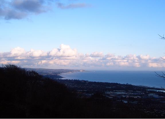
Eastern prospect looking towards Carrickfergus and Scotland

Limestone was mined on the southern flanks of Cavehill in Victorian times and transported to Belfast docks by way of a horse-worked railway along the Limestone Road. The railroad was abandoned in the 1890s. Two small hamlets—Daddystown and Mammystown—were built on either side of the railway track in the early 1820s as dwellings for quarry workers. Some of the local avenues and streets bear the name 'Waterloo', in reference to their geological origins.
Cavehill Tourism and recreation
Cavehill Country Park, Belfast Zoo and Belfast Castle are magnets for locals and tourists alike. In the 18th century the townfolk of Belfast flocked there on Easter Monday for the Cavehill fete, near a spring known as the 'Volunteers' Well'. The summits offers stunning views southwards over Belfast City and Lough towards the Mourne Mountains, Scrabo Tower and Slieve Croob. On a clear day, the eastern prospect reveals views of Carrickfergus and the Mull of Galloway in Scotland.
Overlooking Belfast Lough
|
|
|
|
|
|
|
|
|
|


